Tuesday, May 15, 2007

A Ticket To The Winter Olympics

A two day layover in Calgary to provide time to change money at the bank, do a bit of food provisioning and set an agenda for the rest of the month, left a little time for looking around the city and taking in a few sights.
The photo below shows the 1988 Olympic Winter Olympic Games Park. Most of the snow and all of the Olympians are gone now. It was hard to even imagine this location was once home to world winter sport. This is the venue that made the Jamaican Olympic Bobsled team international heroes of sport. To this day, they are selling Rasta wigs and hats in the gift shop. But without the games, the snow, the national fervor, the site itself seems lonely and empty and the ski jump towers looked like bare bones against the threatening sky.
But not wanting to waste the moment, I strapped on my skis, took the lift to the high tower and launched myself into the sky. Fortunately Marilyn was quick with the camera and captured the moment for posterity. I had a safe landing and scored all 6's on my jump, but one was enough.
We had to do some basic food provisioning as some of the rest of the Alberta portion of the trip will take us through some very sparsely populated areas, and areas that aren't quite "open" yet. For example, the next several campgrounds will accept campers that are self contained only. The reason is that the ground is still frozen- hence no water, no sewer. But we need to traverse the region and we need to do it now, so managing the situation as we find it becomes job one.

We located a farm supply store and traveled there to get the block salt for the coaches water softener system. The GPS in the Honda doesn't "do"Canada or Alaska, so we needed to pull the GPS from the coach and hold it in the car. Calgary is a city of a million people and growing fast. It is a big city- also a very beautiful one. Like all towns in the northland, the construction all needs to get done when the weather breaks for the better, so there was a lot of construction in and out of the city (the GPS figures detours which is why we really needed it).

On the way back we stopped at a super grocery store that had an absolutely amazing seafood department. We bought some "barbecued salmon bits" that were quite yummy. I always love to see what a store has at their fish counter, but this one forced me to take pictures. The one below shows how all the shellfish were held- spread out on trays that had salt water spraying on them constantly. They were all alive, all fresh, and beautifully displayed: mussels, oysters, several types of clams, Dungeness crabs. Went back to the coach and made some nice sushi for dinner.
I can't resist sharing the "crossing" signs we find along the way. This one was in the gift shop at Olympic Park. Our time in Calgary was too short. I would certainly come back and Id love to see the Stampede, which is probably the number one billing for the city.

Sunday, May 13, 2007

Alberta, Canada Eh!

The border crossing was uneventful and pleasant enough. Marilyn used to carry a pepper spray in her pocket book and so when they asked us if we had that, we weren’t really sure. Evidently we didn’t have it with us, so on we went. All of the insurance documents that we jumped through hoops to get were not requested. Neither were the dog records that we spent hours trying to figure out the requirements for. NOT A PROBLEM! Happy to say hello, how are you? Eh? And cruise on through. It was a cold and rainy day for entering Canada, one of the milestones of our trip, and a short run to the first campground which was very respectable and our first impression of Canadian facilities. We know that, being a larger coach, there will be many provincial parks we cannot fit into…or if we do fit in, will probably not be able to get out of- but that is the game of life- seeing where you fit in.
We used our time to download and print metric conversion tables so that we know how fast to go, how cold it will be at night, etc. Even the weather band on the satellite radio reports in metric, and sometimes in French as well. We printed out our charts, laminated them and have them ready for the next day’s journey to Calgary. We reprogrammed the Garmin 7200 GPS to metric as well so tomorrow it will be reading kilometers per hour rather than miles per hour and our risk of inadvertent speeding should be eliminated. I’ve never been a metric kind of guy. It has always confused me…and as a result I have more or less refused to absorb it, or even really acknowledge it. Now I hope to leave that attitude behind and learn it and “feel” it as much as possible. There is a time when you stop fighting that there are some things you don’t want to learn just because you don’t want to learn them, and accept that you will learn them because the time has come that you must! This is that time.
Last night in the “Last Resort” before crossing over into Canada, we met Gary and Judy. We will introduce you to them later- properly. What a wonderfully pleasant, knowledgeable, and well traveled couple they are! They are Alaskan residents, gold mine operators, RVers (full timers). Talk about our kind of people! They were outwardly friendly, generous with their time and expertise in areas that we have only scratched the surface on, and sociable to the point that we turned in later than usual on a night before leaving one country and entering another. They graciously offered to hook up with us when we get to Anchorage and show us the ropes for panning and prospecting for gold. When we came back to our coach after a full evening with them, enjoying their stories and video of Alaska and their camaraderie we looked at each other and the word that came to mind (not "mine") was “fortuitous”. Simply put, we could not have met someone more knowledgeable in things we are interested in if we had looked high and low, put an ad in a paper, advertised on the internet, researched the chamber of commerce for all Alaska. Like just a few others we have met on the road before them, we suspect we have met some real friends- and ain’t that grand!

Saturday, May 12, 2007

Our Readers Ask:

Our readers ask:

"Greg, How were you able to get those incredible shots of those magnificent buffaloes you used in previous blogs?"

Greg:

"I'm so glad you asked. Actually I have modified a technique once used by the wagon train scouts to get close to the herd. Indians used this trick to get close enough to get a shot with a bow and arrow on hunting trips as well. Since I don't have an actual buffalo hide (called a robe) and head to use, I creep onto the Plains wearing a fleece blanket with Koala bears on it (brown side out; green side down) while wearing a cheap buffalo head hat from Mt. Rushmore souvenir shop. I try to stay relatively still in the field in more or less a "Christina's World" position until I can get my shot. I'm always happy to answer your tough questions. Thanks for writing in..."

The technique is illustrated below:

The Forest AND The Trees

Well, first impressions can surely be wrong! On our second full day of driving through Lewis and Clark National Forest we saw both the forest and the trees- millions of them (conservatively!) I hadn’t realized that the plains were going to give way to the mountains and that was part of the park…, uh, forest. So an hour or so into the day and a climb of several thousand more feet in elevation we were in the thick of things- beautifully large and straight pine trees and the patches of snow we had been looking at from down below. Perhaps the expression should be, more correctly, “We hadn’t seen the forest for the mountains.” The same was true coming down the other side. We abruptly left the mountain and the forest and the trees and moved back on to the high plain. The change in topography was swift and certain and more than a little surprising.

Back on the mountain, though, we had stopped at the summit to play in the snow and a snowball fight was part of the agenda. The snow was still soft and fresh and balled up easily so….I wonder how long that little snowman will last.

Before leaving the summit, we talked for a while with the only other RV-ers who had happened along and stopped where we had stopped. It was a couple who lives in Alaska (our destination point) who were vacationing with their teenage grand-daughter who was from, of all places, Port Charlotte, Florida, just a stone’s throw up the road from our Cape Coral, Florida home base - proving once again: It’s a small world, after all. Everybody sing!

This post is made on our last day in the states for some time to come, as we will be entering Canada in the morning. Hopefully we have a working balance between preparation and trepidation, the known and the adventurous. Anticipation is the battery charger of life and we are running on full….


RV-ing Northern Montana

I present the following images of RV-ing Northern Montana for your consideration without further comment:


Ahead Of Our Time


Driving through the Cheyenne and Crow Reservations was disappointingly not noteworthy, at least to the eye of those “just passing through.” We did meet some folks at a campground who were just arriving to work on the reservation for a one year stint, but they were staying at the campground instead of the reservation- seems they were a bit concerned about the idea of the reservation being a “sovereign nation” unto itself and didn’t wish to live among the Indians, even though they were there to help. I did not get enough information to understand the real issues, but found that interesting at the least.

Found people! In the city (town) of Billings. Big, it seems, by Montana standards but not by those of many other states we have visited. The story of the day, though, announced itself coming out of Billings when we caught our first glimpse of the Absaroka Range of the Rocky Mountains- still covered with snow and looming large above the horizon. Our path took us along and occasionally into the mountains. We stopped for lunch at a scenic pull over, and aside from the two Bald Eagles that flew back and forth along the jagged face of the vertical rock wall, we had the place, and sometimes seemingly the state of Montana, entirely to ourselves. Surely we are AHEAD OF OUR TIMES. Or at least the time of the tourist in this part of the country. Since South Dakota, now quite a way behind us, we have not found a single welcome center open. Many of them have signs in the door reading: “See you in May.” Hello. It is May. I know we changed time zones a number of times on the way west, but I’m pretty sure the month has remained the same…
If not, will somebody clue the new guy in please?

They were putting up a new bronze sculpture of Clark (as in Lewis and…) in the Lewis and Clark National Forest. We took the first ever tourist picture of it. Like I said, we pretty much “own“ Montana at this point. Someone’s got to do it! I am still pondering tonight why it is named a National Forest rather than a National Park. My main reasoning here is that we saw almost no tress in the entire park. Is it possible I failed to see the forest for the trees??? Maybe I failed to see the forest OR the trees....

Friday, May 11, 2007

Checking Your Altitude

When I first moved from Pennsylvania to a small farm type house on two acres in Maine, way back in 1973, I was honored to have my grandmother's dining room set given to me to use in the house. It was a perfect fit in every way for that house, and it served as a constant reminder of how much she meant to me, then and now.
She only made the trip to Maine to visit us in the house one time. It was a very special visit. She was not a woman who was widely traveled. This was, I am sure, quite the experience for her as well as for us. But what I remember most about the trip was that she made note of the "elevation" at every chance along the route, saying, for example,
"Oh, it's 11:00 AM and in New York we are at an altitude of 680 feet above sea level."
I have never understood why that was of particular interest to her, but it surely was. She took her information from the state by state posted road signs.
Now many years later, and for whatever reason the fascination, Marilyn and I are making similar notes along our route. When we left Pennsylvania headed West, my parents bestowed upon us an instrument that, for lack of knowing another name (but realizing a coach is not a B-17) I will refer to as an altimeter. Whatever you call it, we use it daily now to note our elevation as we travel. We have no particular need to take note of this information, but we just like to check it and some days going over mountains of some size we check it regularly. An altimeter is not standard gear for RV'ers; for that reason, we feel , well, special! If you wish to know the elevation of our camp near the Little Bighorn in Montana tonight, just blow the picture up and read the outside scale...

Thursday, May 10, 2007

Owning Montana

Some random thoughts on today's drive through the first leg of our three day stint in Montana:

Who owns Montana anyway? You can drive for absolutely hours and not see anyone or anything other than the deer and the antelope playing in a giant field of grass. That's cool, don't get me wrong. But I'm used to someone establishing boundaries, putting up a fence or at least a "No Trespassing" sign and telling all where they can and can't go. Of course as we looked over the expansive grasslands today, we wondered how in the world we would get "over there" even if we wanted to as we were already on the only road around. If anyone does own Montana, they aren't talking about it. Probably don't want to pay those massive property taxes. And further more, if there IS someone living on the other side of this hill - that I can't see is over there - where exactly do they go shopping. No people. No stores. No RV repair centers for sure!!!! Keep on trucking! Oh wait, there's a sign for a saloon just up ahead:

Stonewood Saloon: Cheap Beer, Lousy Food

OK, now I want to know who comes here for even the cheapest beer, especially if the food is lousy? I still don't see anyone around the joint. Beautiful state, but mystifying!

At the end of the day, we crossed the Little Bighorn River and site of Custer's Last Stand. Custer's men are buried in the cemetery there, but he himself was "transplanted" back East somewhere near West Point. That is one of history's battles that I do have a particular interest in. It was a battle that had to be fought. It was a battle that had to be won, for both sides. But in the long run, no one won the battle and all were lost in the end.

OK, Now I'm wondering how long that Stonewood Saloon has been around. Maybe the General and the boys stopped in for some cheap beer and lousy food before heading into that valley of death. It mighta happened that way- cause Lord knows I still don't see anyone around here.


Jacks Are Wild
This is not a poker term in Montana. (There's no one here to play poker- even at the saloon) Here it means you might see a Jack Rabbit or a Jack Ass or even the mythical Jack-alope. And whatever you see- it for sure will be wild- cause ain't no one around these here parts other than the jacks!

I'm anxious to see more of Montana. There must be someone around somewhere...and I want to know who owns Montana!!!

Why, Oh Why, Wyoming?

There is a theory for everything. Usually there is more than one. There may be a religious theory, a scientific theory, a science fiction theory…and then there’s folklore.

President Teddy Roosevelt set aside the so called Devil’s Tower as the nations first NATURAL monument in 1906. I have no idea and no theory, personally, on how it got the name of Devil’s Tower that it carries today---and I don’t plan to offer one; which is good for me ‘cause getting into religion at this hour of the night doesn’t suit my plan. But I would like to talk about the other three types of theories that attempt to explain the creation of this colossal rock right smack dab in the middle of nowhere in Wyoming.

First lets take a look at the rock itself. If you’re new to the blog, please understand that clicking on any picture will blow it up considerably. You can use your back arrow to return to the blog from the enlargement. I know- I keep repeating this feature, but we seem to be drawing new friends and readers all the time, and I’d like them to have the benefit of my technological wizardry. (Can anyone help me get my tongue out of my cheek?)


If you’ve never been to Wyoming, but do think you recognize the Tower, it’s probably because you are a sci-fi fan and just happen to love Close Encounters of the Third Kind. It seems that in that flick, the government was secretly sending out signals to aliens in the form of intergalactic music that was boom boxed out of the tower unbeknownst to all, who also found themselves mysteriously linked and drawn to the Tower. As it turned out, the inside of the Tower was set to receive the alien space ship and all ended well as the lovable and loving aliens landed and did their thing. So there’s theory one: The Tower was built by the government to communicate with beings from outer space. It’s a bit far fetched. After all, much of what the government plans gets screwed up along the way, and this actually worked!

Now for straight science. Millions of years ago, there was an enormous volcano on this site. There is evidence to this that I have seen with my own eyes and touched with my own hands, so perhaps this is the workable theory. After many centuries of erosion caused by water and weather, the outside shell of the volcano fell away to nothing and only the hardened material in the cone of the volcano remained to form the Tower. It’s believable, don’t you think? But like most science it raises more questions than it answers; after all, that’s the nature of the scientific method. Where is the outside of the volcano? Where do you see enough water to make this happen? Just how bad is the weather in Wyoming anyhow? And on and on…Plausible, but a bit matter of “factly” boring for my taste.

Then there is the Indian folklore. It tells the story in terms we can understand for the most part- in terms of the land and sky and the animals and the children and the power of the almighty forces that be. Exaggerated a bit perhaps, but I’m OK with that. What do you think?

One day, an Indian tribe was camped on the banks of the mighty river. Seven young girls were playing not too far from the camp. The region was known for its very large bears and one of them began to chase the girls. They tried to run back to their village, but the bear was gaining on them and just about to catch them. The girls sought refuge on a rock that was no more than three feet high, and they began to pray to the rock, saying,
“Rock, take pity on us; Rock, please save us.”
The rock heard the pleas of the young girls and began to elongate itself, raising them up and pushing them higher and higher out of the reach of the bear. The bear, angered by this big magic, jumped and clawed at the rock until he broke his claws and fell to the ground.
The bear continued to jump and claw at the rock until the girls were pushed into the safety of the big sky, where to this day they are found in a group of seven little stars (the Pleiads). The marks of the bear’s claws are evident in the sides of the Tower to this very day.

So magical is the appearance of the Tower that it really is not all that hard to accept the legend as fact. But have a good look at the pictures, and then decide for yourself.

Wednesday, May 9, 2007

Digging South Dakota


This is the land of the Indian. These days, political correctness asks us to say native Americans. I don't know. I like the word Indian- always have. I have tremendous respect for their history and their culture, then and now. In the picture below, the Lacohta Indian lends his grace and silent power to the Prairie Edge- a store that specializes in high end art of the Lacohta. No tourist trinkets here; this is all for real, from buffalo robes and leather maiden dresses to jewelry and bone breast plates and feathered head dresses and peace pipes. We had planned to duck in for a glance and wound up staying a long time and talking to the native staff about what we were seeing.
The Lacohta, the Dakota, the Sioux- this is their land. It has their mark upon it. You can feel it.
As a child, when I visited my grandparents house in the city, the place mats at the table were most always filled with Indian Chiefs. I honestly don't recall why they had them, but there they were, telling the story of proud men- Sitting Bull, Crazy Horse, Chief Joseph just to name a few. From the stern faces, the heads held high, the costumes adorning their bodies and the short story about each, I stated to build an affinity for the Indian. Later, in camp, I met and actually became blood brothers with one Jody Ruth, a full blooded Cherokee Indian. I lost touch with him a long time ago but the event and the memory of the ritual remain a special one for me to this day. My family had many an outing in the corn fields of Pennsylvania hunting arrow heads and other Indian artifacts along the Schuylkill River. I had forgotten about most of that until coming here. It's so nice when the present helps you to recall the wonder of your past. Oh and one more connection- my best friend in the world is part Passamaquoddy Indian from Maine. I wish he could be here to share this time at this place with us.


The National Monument: Mount Rushmore. On a rainy day, we visited this classic tourist attraction- and we were not disappointed. It rained just enough that the presidents had giant tears running down their faces. Eerie perhaps but it added a dimension to the sculpture that few will ever see.


The Needles: Stellar rock formations near and somewhat within Custer park. The camera couldn't capture their size, but you sure do feel it driving between the towers or through the carved out tunnels you must traverse to get through them. No coaches on this road. Some cars and trucks can barely make it.

Custer State Park (SD, Custer National is in Montana and coming up next) was loaded with wildlife. Real wild wildlife. This ain't no Busch Gardens, baby. While we did find many of the animals tagged, some even with tracking transmitters, they are free to come and go and roam as they see fit within the boundaries of this enormous park system. What we saw, we had to WORK to see. No pay your money and have a drive through here. It was reminiscent of the Indian scouts send up ahead to find game, buffalo. Here's our list of what we saw (and there were quite a few things we could not locate in the park on this occasion): buffalo, deer of several kinds, pronghorns, wild turkeys, prairie dogs, elk, mountain goats (actually that was just outside the park below Mt Rushmore), wild burros once used to transport visitors to the top of Harney Peak, and so much more.


I may still be searching for the Great White Buffalo, but at least I found this white wild burro. Actually, as you can see, he found me.


There are signs in gift shops and gas stations in the state that state: "You know you are in South Dakota when there are more Prairie Dogs than people." Well we must be here I guess. I have no idea what the multiplication factor would be but it must be 100 to one if not a million to one. They are everywhere where the high plains are found and they are everywhere on that plain. They are cute, adorable, noisy and fast as lightning. They have it in their dna to sit up, look around, pose for the camera and then drop back into the hill before the shutter can open and close on the camera- hence, millions of "doggies", only one blessed photo!

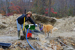
Talk about "digging" South Dakota! After attending the GPAA (Gold Prospectors Association of America) show in the Black Hills in Rapid City, where we picked up a few prospecting supplies and attended several workshops on the topic, we headed out to the GPAA gold claim just outside of Sturgis- and had our first crack at it. We dug and panned and processed for about four hours in the afternoon on a magnificent day. Our reward: 11 flakes of real gold. Beautiful gold. Let's talk about gold with respect to size and value. A piece of gold encased in a vein of quartz and weighing a couple pounds or more is a boulder. Next comes the nugget, both large and small. Then comes the "picker," big enough to pick up with a tweezers but too small to grab easily with your fingers. Then the respectable "flakes" of gold, followed by "powder." We found flakes. Value? At nearly 700 dollars per Troy ounce, we did not get rich on this outing. We did not pay for our gear and equipment. We did not pay for the gas to get to the claim. We did not pay for the self packed ham sandwiches we carried to the site. . .And we probably didn't even cover two Diet Cokes to go with the sandwiches. But we found gold on our first time out- which says to us, our preparation has been good, our education has been fruitful and we are on the right path for having a most rewarding, in experience if not dollar signs, hobby. When we came home, we were quite pleased with ourselves. We were quite tired. We slept great.
And I think Marilyn looks so cute in those hip boots!