Saturday, August 30, 2008

Dismal Days Discoveries

No reflection on the natural beauty, activities and people of the Canadian Maritimes, but we certainly have targeted some of the worst weather possible for our visit to the area. Seemingly we have been in cold, wet, rainy conditions for weeks on end now. One “front” moves out for a few minutes and then the next rolls in. Blue skies have popped out for very brief periods only- and even then it is so windy we have felt like the kayaks might get ripped right off the top of the car. But our time here is what it is, so we have done our best to fit in activities that we can fit in where we can fit them in.

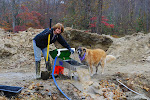
From our base at the beginning of the Cabot Trail and Cape Breton, we took our first scouting jaunt off the trail and close to base. The better the weather, the more you see on the Trail and vice versa. So off we went in a different direction while waiting for something better weather-wise. Now this location is on the fringe, as I have said, of what works and what doesn’t. No satellite TV here. Seldom, cells phones. Occasional radio. Even the GPS gets easily confused, so it should not have come as a surprise that our first outing found us off the planned route and driving in deep puddles and mud on a dead end road. Well, color me scenic and get me back to the coach.

We did find a closed up rail museum on our unplanned route and I thought this old rail snow plow was a pretty neat old rig.


And then on this cold and overcast day, we found a bunch of local kids having some fun by jumping off the road bridge and the nearby railroad trestle into the river below. Kids don’t much care about the weather. Fun is fun: let that be the lesson….


One of our intended activities here was the renowned Captain Zodiac’s whale watch excursion. Most whale watches put you on a steel hull, diesel driven cattle boat and take you out to sea. You stay high and dry and maybe get close enough to see a whale or two. Some are better than others. So we were psyched to go out on the smaller and faster inflatable boats to get up close and personal with large numbers of whales. But day after day, the weather disrupted our plan. The trip couldn’t go because of weather, high seas, high wind- whatever, on several occasions. This is not the norm; they seldom have to cancel. So rather than waste the day even with the hour over and hour back already lost each time we attempted to take the trip, we found some places to explore between hither and yon that didn’t rely as much on nice weather. Margaree Valley and the river by the same name are famous for Atlantic Salmon fishing- and the season has already begun. We visited the salmon and trout hatchery along the river, and watched some talented fly casters fishing along the nearby banks.


Another marginal weather day was not OK for the whale watch but it was OK for driving the Cabot Trail loop around Cape Breton. Figure six to seven hours of drive time, punctuated by whatever time you need to stop and take pictures, poke around in local businesses, and grab a bite to eat. We knew it was going to be a long day, so we ALL packed a bag and our rain gear and headed out to see the Cape. Even in less than perfect weather, this is a most amazing place to see.

Slide Show: Cabot Trail and Cape Breton


Then on our second to last day here, and just as we were starting to resign to the fact we might not get to go on our whale watch, the weather finally let up enough that we could get out in the zodiacs to see the whales. The weather was still off and on. Some wind, a few high seas on the way out, lots of sea spray and some very cold water coming over the bow and the sides. Picking the times to get the “good” camera out of the dry bag and take some shots was a challenge, but fortunately the reputation of the good captain was well deserved and he put us among so many whales we didn’t know which way to spin next- they were all around the boat pretty much the whole time we were out on the water. And the good captain took care to keep me and my camera as dry as possible. Captain Zodiac’s adventure is a “No whales- Money back” guarantee and at least for this day, there was no worry about that! And from what we have heard, there seldom, if ever, is. These are long fin, pilot whales and are here in large numbers from Spring until some time in December. There was at least one calf in the pod that we spent our time with. They are frisky little rascals and seemed to enjoy rough-housing around the zodiacs. On a calmer day, we may well have even been close enough to touch them, but the jostling seas kept everyone at a safe distance on this day- but surely close enough (often within 5 - 10 feet) to be truly exciting.

Slide Show: Captain Zodiac Whale Watch

Monday, August 25, 2008

Ride The Wild Bore

Nova Scotia seems to be half way between the sublime and the ridiculous. The scenery is beautiful, the tides extreme, the outdoor activities challenging and invigorating. But sharing those experiences through the blog has been quite the issue. Our cell phones and pc card connector for the laptop have been at the intersection of “where I’ll work and where I won’t.” Some of the campgrounds have wifi (or actually they THINK they have wifi) but they either can’t connect because of a cloud or the rain or a tree or a rotor or something else. At the last stop, they told us their system had just been hit by lightning. Possibly. But I think that was putting the best face on a bad system. I did manage to find a spot driving around in the car where if I was willing to twist and turn and type on the keyboard with the computer in the seat next to me and the windows down I could get a few things done. Oh, yes…and all those mosquitoes we did NOT see when we were in Alaska? They are all here. They are mean and they are hungry. And they seem to prefer Americans over Canadians.

Right now I’m typing this in a word file in the hopes that the cafĂ© in the village of Baddeck will be able to keep me connected long enough to cut, paste, and upload whatever it takes to activate the post.
Now if you thought I spelled “bore” wrong on the title- you would be wrong, not me. This ain’t no hog. This is a tidal bore: the sudden return of the tide to the flats and rivers in an area with an extreme tide. The bore looks rather like a wave going the wrong direction. Even in the river where the water running out to sea is fast and furious and making rips of its own, the bore rolls right across those rips, reverses them, and makes for some pretty impressive standing waves. If you were stranded on the flats by the rapidly returning tide, you’d be in deep do-do, not to mention deep water, in a hurry. But in a rubber white water raft, piloted by someone who knows what they are doing- it just makes for a good time and a wild ride. And so we set out to do just that, ride the bore tide at Shubenacadie with the Shubenacadie River Adventure Tours in South Maitland, Nova Scotia.

On the way we found a Bald Eagle bathing in the reddish brown muddy waters of the river. Clear, pristine water this is not. Terminally turbulent and “chocolate mud slide” it is.

It seems like even the local sculpture passes comment on the fact that once you are in this water- you ARE gonna need a bath.

We have the feeling traveling in Canada and especially in Nova Scotia that we are “up north.” There is a tendency to think we are a long way from the equator and pretty darn close to the arctic circle. In reality this is the exact half way point between the equator and the North Pole- and here’s the sign to prove it at Mammoth Ridge.

The river and the old canal look harmless enough at low tide. Not much action at all. But come the tide, the place will have some 20 - 28 more feet of water depth, long series of 8 -10 foot standing wave rapids, and 30 or more rubber rafts each filled with 12 or so screaming people riding over, through, and occasionally under, the waves…and getting soaked to the bone doing it.


There’s one spot at the canal marker where there’s an observation post for those who don’t want to ride the wild bore, or even get a bit wet.

And just up river from that spot is where you can go to slide down the extremely slippery mud banks into the river. Getting down is easy. Getting back up? Not so much.

Below, you’ll find a slide show from the raft trip. The first images show us walking down to the river and loading the boats. Then we ride down the rips to the mouth of the river and get out and stretch a bit on the mud flats. Mud wrestling and mud tossing contests occupy some until the “Back in the boats” command is yelled from the tour leader. There is no time to waste. Next, look for the white foam line tracing the shore line and creating that first “up river” wave - that’s the beginning of the bore. Then you’ll see us riding ever increasing sets of waves as the tide bores in heavier and heavier. Many of us thought when the waves hit two to three feet in height, we were already riding the bore.
“No,” said skipper Jeffrey, “this is just a warm up.”
Ten minutes later we were soaked and bobbing up and down over 8 - 10 foot waves. As you look at the pictures, keep a couple things in mind please:

1 This ride is rougher than it looks.
2 I’m the only one in the boat holding on with only one hand
3 I’m the only one in the boat crazy enough to try to photograph this ride
4 The blurs are water drops on the lens and a moving camera hand
5 It’s hard to do a photo shoot with waves pounding you in the face! And…
6 This ride is rougher than it looks

One further bit of info if you decide to watch the whole show: When the girls who wanted to be in the front of the boat move to the back of the boat and the guys are forced to move up- that’s when it started getting pretty rough. Me? I was in the back of the boat taking pics the whole time. Lucky me!

Thursday, August 21, 2008

Small World....Big Pumpkins

It may be a small world. Even on our hour and a half drive from our first base camp in Nova Scotia to our first stop at Howard Dill Enterprises- grower and seed provider for the world’s largest (and this time I am NOT exaggerating) pumpkins in Windsor, NS, we bumped into a handful of other tourists who pulled over to ask us what part of Florida we were from. It’s a long way from Florida. So to be bumping into people from Ocala and Orlando and Fort Myers seems as much an oddity of what we were headed to see. Maybe this pumpkin patch exists in a small world- but it, like Charlie Brown’s Patch, is chock full of giant pumpkins.

Howard Dill Enterprises grows and displays and gives very personal family directed tours of this, perhaps the best pumpkin patch in the whole world! Having purchased seeds from them MANY years ago when I was into some very serious gardening of my own on the coast of Maine, I can assure you their seeds are tops and will yield absolutely amazing results. So we were thrilled when Danny Dill, Howard’s son, gave us the tour of the patch himself. His knowledge is outstanding. He’s personable and able to tell a story with the best of them. We really enjoyed the time with him.

Keep in mind we are visiting mid-August. So while some of the pumpkins have already surpassed the 500 pound mark. Most if not all of them are still growing and on their way to 1000 pounds (plus or minus) and a few way more than that. People grow them as a curiosity. Because they can. Because watching a pumpkin grow at an average rate of 30 pounds a day is amazing in and of itself. You can snag that blue ribbon at the agricultural fair. You can show off to all your gardening friends. You can grow a jack-o-lantern so big that no one without a tractor can even steal it off your front porch on Halloween, let alone smash it in the middle of the street like some are want to do. And here’s one you may not have thought up yourself- you can hollow one out and enter it in a boat race! That’s right. They actually have a great pumpkin regatta here. It has drawn huge crowds from its very inception and continues to grow annually. Martha Stewart Omnimedia, Farmer’s Almanac TV, Home and Garden TV, and Ripley’s Believe It Or Not have all covered the event at one time or another. If our timing were a little better, we could have brought it to you first hand on Gundyville On Wheels, but for now a link will have to do!


I took a close up shot of one of the newest “sets” on the end of the vine runner for an Atlantic Giant. Hard to believe that something so large results from this pea size set at the end of an orange flower- but it does. You can get seed, directions, and lots of growing tips from the Dill web site. Be sure and check it out.
Danny uncovers some pumpkins for inspection...

and tells us secrets of the trade.

Tuesday, August 19, 2008

Cape Enrage and Lobster Mania

We caught a one day break on the weather pattern we've been stuck in for quite a while now and took advantage of it by scooting over to Cape Enrage to see the lighthouse at the cliffs and the rappelling and zip lining school that is operated there by some local students. New Brunswick has been "hilly." Steep ups and steep downs and not too many areas of flat at all. I found it more of a challenge to drive the coach here than in the Canadian Rocky Mountains. The grades aren't near as long but they are even sharper inclines and declines over short stretches- the minute you get rolling along nicely, it's time to start braking again. Challenging, but interesting.


Cape Enrage is described by some of the brochures as "the most beautiful scenery in all of Canada." to my taste it wasn't quite that good- but very good none-the-less and just having a blue-bird clear day made it seem all the better.

The construction of the beach was quite unusual. Up higher on the beach where the water hits with less regularity, there was a bed made entirely of flat stones, the kind you like for "skipping" on the water and over the waves.

The portion of the beach exposed to the constant batter of the tide and wave action was composed of smaller and rounder rocks. It was an Alan Magee moment for me.


If there was any thought of riding the zip line, it ended when we saw how abrupt it came to the end of the run...and failure to end the run by design would have meant smashing feet first into the ledge at the end of the run. I had a hard time pretending that would be a fun thing to do. Think I'll wait for a tree top rain forest run some other place some other time.

The lighthouse itself was rather small, especially in comparison to the size of the rocks it warned of. In this case size DOESN'T matter. But hold that thought....


Slide Show Rappelling at Cape Enrage


So far, we had walked from the parking lot down to the keeper's house. Them up the stairs to the light. Back down the steps to the zip line station. Down those stairs to the "stairs to the beach." Then down those stairs to see the rappelling brave at heart drop down the face of the cliffs. Back up the stairs again to the gift shop. Up the stairs to the parking lot. All these ups and downs sure can make a guy hungry!


So we stopped at Butland's Seafood market on the way back to the coach. There we found the largest lobster in the world for sale. Well, maybe not THE largest one, but darn big regardless. The price was right! By Maine standards it was downright cheap. And by Maine standards it was also downright enormous. Way too much lobster NOT to think about the next SEVERAL meals. We took it home with us.

With several well chosen added ingredients, we set off to build a feast. (Hope that will be the topic for another time....

But before we could start, Abby needed to make sure she knew exactly what was going on. I'm sure she was thinking as we were, "haven't seen one like this before". 9 Pounders are few and far between.

Polite little creature that she is (Abby that is to say) she remembered to thank Marilyn for the informative session.

And then it was time to drop this monster into the biggest of all pots filled with boiling water and dulce (at least the biggest pot we had on board).

Now think back to earlier in this post. Remember when I asked you to keep in mind that "size doesn't matter?" Well, here is the lesson to state the obvious. Sometimes size does matter! Ooops! No further comment!

Monday, August 18, 2008

Hot Rocks

Hopewell Rocks is to the East Coast what the Sea Stacks of Washington State are to the West Coast. Large rugged chunks of rock that time and water and other effects of erosion have failed to pull down into the mighty sea that surrounds them. They are “curious” in part because they are so rare and unique; but there is something symbolic about their resistance to chance that draws us to them as well. Here in New Brunswick, where the tidal change is extreme, yet another element of magic is added to the viewing on the rocks- the fact that sometimes they actually “rise up” out of the water and permit a brief exploration up close and personal. Before you do that, though, there are a few things you need to know: first, the real time (synchronize your watches, y’all), second, the time the tide will be out and the time it will return and, third, the time by which you MUST return to the pillar of steps that brings you back up from the beach. Since the tide comes in FAST- rising 6 feet per hour- getting stranded on the beach and away from the only return route would not be good! That’s six VERTICAL feet per hour- which of course covers a whole lot of beach in short order. It is the only place we have ever been where you can actually SEE the water rise- it happens that fast!


Here are some comparison shots between nearly high and low tides:


And a few to show the scale and detail:


So here we are at one of the lookout stations on the path down and back to the Hopewell Rocks. More than a few onlookers are jostling for position to get up to the rail for that “we were here” mandatory tourist shot. Inevitably the rhythm and order of the process breaks down and someone steps in front of your otherwise perfect shot. Some just wait. Most laugh a bit. A few will fume. But it’s all part of the process of sharing the globe and so while it may be easier to get the shot with no one else around- that’s not the way things usually work out. They don’t call it “The beaten path” for nothing you know. Now there are more than a few waiting behind me for their turn at the rail. The French gentleman in the shot with Marilyn was going out of his way being polite in order that I might get my shot. Even going to the effort to “hide” himself from my shot by ducking repeatedly behind that tree trunk. His lady friend is behind me waiting to get up there when we are finished. But I was not trying to take a picture of Marilyn alone- I wanted one with her and him looking off to the bluffs beyond. My ability to convey that must have left a little something to the imagination, so he just kept on trying his best to accommodate me. Then, as best exemplifies international recognition of common goals, Marilyn resolved the issue in her own inimitable fashion: she hugged him, smiled her nicest, and posed with him. We all have a nice picture…and a nice memory and a new friend.

While they may be grand and glorious- “Rocks Is Rocks.” So in the face of their sheer beauty, a couple of dogs and some ice cream can still steal the show. Had these two setters been able to do this all day, they would have been an even greater-than-the-rocks tourist attraction. Slide show follows:


Saturday, August 16, 2008

Bay of Gundy....Uhhh, Fundy

The weather cut us a one day break for our trip across the Canadian border at Calais, Maine. Upon crossing, we had a "first" on our journey in that we set the clocks to "Atlantic" time zone- an hour later than Eastern. That weather was still with us when we pulled into the village of St. Martins, New Brunswick, and took our reserved camp site looking out across the Bay of Fundy. Known for its mighty tides, the bay started showing off its goods right away. Across the cove from our camp- the beginning of the Fundy Trail and the famous sea caves that introduce the trail and the park in which it winds its way along the bay. It was late upon arrival, so we were content to "shoot" across the bay with the longer lenses, taking a walk on the round rock beach, and just enjoying the overview of the bay and the low tide that exposed a tremendous amount of the flats. There are places here where at low tide, the water is several miles away from the shore. Hopefully, that amazing tidal change will be properly documented as we travel around the area.


Below is the shot from as close as we could get with the tide at this level. Though already down quite a bit- it will go much lower....much lower.
Marilyn dwarfs at the mouth of the largest of the caves at low tide...
The next, and our only full day here, the weather retreated to heavy fog and rain. That meant that the incredible vistas of the Fundy Trail would elude us. Still, there are things to see and do along the trail, no matter what the weather so we set out to do that. The stairs to the falls were so steep, they are actually a type of suspension bridge- 4 x 4's strung along a heavy wire cable, flexing all the way down and all the way back up. My legs hurt when I got back to the car!

But as everything else here, the sight was worth whatever work it took to see it.

There is a sub trail that hikes you in to the sea captains family burial plots. I had the feeling we were walking in the woods to no-where, but eventually we came upon a number of picket fence-enclosed cemetery plots with tombstones dating way back. We had the trail to ourselves on this day and it was a nice experience.

Back on the trail, the fog and rain were not letting up. Once in a great while, like below, we caught a glimpse of some of the intended views. But as a rule, the fog won the day and hid its coastal booty from view of the lens.

The river flows into the bay at the end of the trail at the interpretive center. We had some limited visibility here again.

I took a picture of this boat floating when we started the trail. When we came back out, it, and all of the other boats in the protected harbor, was high and dry.
And here is my sign of the day: Like much of the road signage here in New Brunswick, instruction is given in both English and French. This sign advised of a steep (14% is VERY steep) decline going down to the interpretive center. My "French" is nearly non-existent, so if this is a full translation- all well and good. But it looks more like English speaking drivers should test their brakes, and French speaking drivers should verify that they know who their friends really are before heading down the hill.... Ya think?


And finally for now a slide show from our low tide excursion to the sea caves on the Bay of Fundy: