 But a few days back, the writing was on the wall....actually it was on the Yahoo! weather report, but you know what I mean. The rain was coming. It didn't seem like we would be able to "duck it" (get it?) this time. And sure enough. It rained hard at times last night. It was raining and a blowing when we got up this morning. And it looks as though there could be a bit more tonight and on in to early tomorrow. But why write about a rainy day? It's no biggie, right? Oh, but it is! This is the desert. For real. They don't get much rain here, and when they do get it this time of year, it is the forerunner of good things to come- the desert in bloom. And in truth, one of our biggest reasons for wanting to be here at this time is to be here when the desert begins to bloom. Two years ago we "pulled out of Dodge" too soon. We had seen many beautiful sights, and a few species in flower, but not the significant bursting forth that the desert is capable of. We vowed to ourselves then that we would come back to be here, to experience that as soon as we could arrange to do so...and here we are. Unless, the expectation of the mind is playing tricks on me, the desert foliage, such as it is, began to green up already in just a day. And a few small daisy like flowers popped out immediately alongside the road today. They weren't open yesterday. We didn't get enough rain yet to make the "dry" washes run with water, but presumably that will come at some point heading into Spring. But already the so-called creosote bushes (no relationship to the wood preservative of the same name) are throwing off the sweet smell that is characteristic of them whenever they get wet with rain. It is a pleasant change from the smell of the desert dust, which also seems to have its own distinct aroma- not bad, just not terrific.
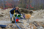
So knowing that the rain was coming, we set out to accomplish a few things we felt we needed to do before it wet things down. Armed with our dry mining apparatus packed in the van and a map that Lynn was kind enough to print off his computer, we set out to find the locations of two mining claims. We had been to them two years ago, in a follow-the-leader- type situation and thought with the maps and our new hand-held gps unit that we should be able to find them on our own. I've been wrong before- so this was not the first time! While we had the map, the gps, and some area familiarity, we just didn't have enough way-points noted to be able to stay on the necessary track. So we did what most people do when they are "lost"- we went in circles. It didn't help matters any that one of the printed instructions to the GPAA claim told those seeking it to "keep to the right of the main traveled path." For starters, we should NOT have stayed to the right. And anyone with minimal experience on desert trails, and especially those with NO experience riding at the head of the pack, that tells you they know which is the "main traveled path" from the hundreds of criss-crossing paths that wrap around the base of mountains and run through washes and up the other side a hundred yards "downstream" may or may not be telling you an outright lie, but he is most assuredly suffering from delusions of grandeur. So after 3 hours of circling the wagons (I love it when a theme repeats itself) and after having taken some wrong turns on tight paths and putting a few scratches (sometimes referred to as "desert pin striping) on the van, we limped back to camp feeling less than accomplished. We had tried and failed- make that "not succeeded"-but we had learned some valuable lessons. We learned what info we needed to have in order to be successful on the next attempt. We needed way-points. A lot of them. Latitude and Longitude coordinates for points on the map where-ever a turn needed to be made accurately. More detailed mapping. And again, with Lynn's help we gathered the materials to work on that over the next couple days. There was a feeling that maybe we still wouldn't reach our destination and we hemmed and hawed about trying again on our own for two days.
But ultimately we decided to go in with the ATV and not the van. More maneuverable in tight quarters- meaning that we could turn around a whole lot easier if we got off course. Marilyn entered 18 way-points to each custom trip to the two destinations after I used several computer programs to determine what they needed to be. Mapsource gave me the routes, Google earth gave me the topo features. The Honda ATV also has a "bread crumb" gps unit built in, so we marked our trail at each and every intersection and turn. If nothing else, we could track ourselves back to where we started. This time it all came together and we found not one, but both of our destinations, and with enough time to spare before we needed to head back out to the van that we did some exploring of other claims while we were back in there. Track one covered about 7 miles each way in and out. Track two about 6 miles each way in and out. We noted each and every way-point in and out for learning purposes. Using a gps in the desert where there are no real roads is way different than putting in a town and driving down the interstate.
Now if I made any of this sound like for one minute we were at any risk of getting really lost, let me clear that up. Not finding a needle in a haystack is not the same thing as not knowing where the haystack is. I bring in the haystack analogy in deference to our friend Farmer Don, who while leading a ride one day pointed out a valuable but obvious tip and taught me a valuable lesson:
"Just look around," he said. "The flat top mountain over there on the horizon is the direction home. The water towers on the side of the mountain mark the campground. There's a ranch you can see way over there from any high point, and a cattle yard over there. The cell phone towers atop the sharp peak mark trails on either side of Rt 10." Now paying attention to those things instead of the rider in front of me and behind me, I never felt for one second like I would be unable to find my way out should push come to shove.
So before the rain arrived we had located two spots we will return to when things dry up again and get back to some prospecting. But what to do on a rainy day in the desert? There was a chili cook off being held up in Wendon. Where is Wendon, you ask? We drove northeast in the general direction of Salome, AZ. We had to go past the village of Hope, AZ. The good folks of Hope were nice enough to put out a big sign welcoming visitors and passers by to Hope. They also put up another sign to let us know: Your (sic) Beyond Hope. Gonna need some work on the spelling on the sign, but clever and memorable- I like that. But come to think of it, it may not be the first time someone told me I was beyond hope.

 pistachios on the tree


