Wednesday, June 27, 2012

Stout Grove and More

Busy Day! On the agenda today: A visit to Rowdy Creek Hatchery for Chinook and Steelheads run by the Kiwanis Club, a drive and a hike through an old growth Redwood stand called Stout Grove in the Jedediah Smith part of the Redwood Forest, a stop by the mammal rescue unit, and an exploration of Crescent City Harbor including Fisherman's Pier.

Highlights of the day: First, at the hatchery, the fry in the steelhead tank were barely an inch or so long but they were trying to jump up the water stream that was falling about 6 inches or more from a pipe into their tank. It was a riot, and something that I have never seen before at any hatchery we have visited. Amazing little fish- training to be amazing big fish. Second, the dirt road that carries you though Stout Grove is barely wide enough to get you between some of the trees. It, however, is a two way street, which made it kind of hairy on more than one occasion. Besides, it was slick from all the rain we are having and a couple times we did some slipping and sliding in spots where I thought we would go over the edge and be in some real trouble. Fortunately, that didn't happen. Man, those were some big trees! And finally, it was great to see dungeness crabs caught left and right at the fisherman's pier, where, you are permitted to crab and fish without a license. Tomorrow we'll try our hand at crabbing with the three traps we bought today. Psyched about that!

Chinook Fingerlings


Dungeness Crab


Tuesday, June 26, 2012

Ocean World- The Original

Another cold, rainy day. Drove up the coast to Crescent City to Ocean World. Now we've been to aquariums all over the place- there is always something new and fascinating to see. This Ocean World is small. Really small. And as an actual aquarium goes, it has very little- only a few local sea water species and they are housed in poorly lit quarters. But what makes this aquarium interesting is that it is entirely housed in an old barge. And even more unusual, this barge used to be the home of the Seattle Aquarium which is now a world class aquarium that we visited last time we went to see Derek and Karin in Washington State. Small is not necessarily bad though. They have three harbor seals and a California sea lion and a trainer that does more of a conversational routine with his animals than the standard trick performance of most of the sea world type set. The crowd was very small, the area was very small, we were all in a close encounter of the Ocean World kind....and the show was actually very different and very interesting and very well done. A sub sea level aquarium housed in a barge on a dark and dreary day is not a good place for photos so there aren't very many, and maybe not very good, but they will serve as a memory for another day at the aquarium.

About this photo? Yea. I know. But I couldn't help myself.


Monday, June 25, 2012

Too Close For Comfort

It seems I have some time to post again this morning. I guess it ALWAYS rains in Northern California! Went out just for a bit yesterday to do the drive thru tour tree. We took a tape measure, lined it all up, and then decided it was just too close for comfort. Price to drive through the tree is 5 bucks. The nice lady at the booth only charged us 2 because we didn't fit. Still had the photo op so it was such a deal!


A few other images from the day:


Sunday, June 24, 2012

Redwood Coast

More rain! We haven't been involved with two solid days of rain in many months. The owner of the campground told us it doesn't rain this time of year. Really? Could have fooled me, and it's looking like rain again today. But yesterday, we did a scouting mission to see what there was to see in the area. And it was a good thing we went out because the overcast and damp weather actually helped to get us very close to some wildlife, and we happened upon some activities that we may otherwise have missed.

Not far out of camp on the Redwood Highway, we happened across a meadow where the signs suggested we should keep an eye out for wild Elk. Sure enough, we spotted a couple standing in the meadow and then noticed a whole lot more lying in the field. The herd, part of the area herd known as the Roosevelt Herd, was very close to roadside- say maybe 20 feet from the pull over. A bit later, we were headed into a portion of the Redwood Forest and again in a meadow on the edge of the forest, I spotted a family of black-tailed deer, a doe and two fawns still wearing their spots for camouflage. We found the small coastal village of Trinidad so we could fuel up and grab a bite to eat for lunch, and happened upon their Fresh Fish Festival. We had some shrimp and some true cod that were very fresh and very good. Why they were barbequing chicken on the pits I'm not sure, but they were nearly sold out of that too. In Orick be stopped to see some redwood carvings and woodworking shops and we were surprised to learn there how redwoods reproduce....when the tree is damaged or downed, the chemicals in the burl wood changes and begins to sprout. Seeds are useless unless a forest fire activates them. They had some burls growing in water tubs and I found that totally fascinating (look for that in the slide show). We also came across some black sand beaches in the foggy weather as we drove along unpaved, narrow, scenic coastal highways and collected some nifty little pieces of driftwood.


Slide show and some stills will share our day with you:


Friday, June 22, 2012

Klamath Landing

The north-south backdoor to coastal Northern California forces you north into Oregon before looping back around and coming down 5, then 199, then 101 to Klamath River by traveling beside the Rogue River. I don't know quite frankly which superlatives to use regarding the scenery because I was too busy wrestling my steering wheel to keep the coach and the Quig from getting stove up on the overhanging rock ledges that abut the road and/or the redwood trees as they got bigger and bigger and bigger as we got closer and closer to the coast. The road gets narrower and narrower the whole route. It's touch and go at a lot of spots. Tight! To the point that a long rig (that would be us and the tractor trailers) all had to make wide turns on a road that is not really wide enough to permit that. Which is why I am sure two of those trucks hit head on on one of the switchbacks. It made for a real mess for a while. Just glad it wasn't us- because it sure as shoot could have been....

"So when you are cursing me for sending you down this road by the time you get to the end of it, just remember that is the best available of all the routes that can get you where you want to go.." said a man to Marilyn a couple of campgrounds ago. Experience counts and Marilyn had talked to several big riggers who had come in and out of here on all of the possibilities. This route was their recommendation. And by all we have read, it IS the best. Which, after you drive it, you will realize that is not saying much! Here for about 10 days, we will explore with the van- however, we still have to get out of here and head back to Oregon when we are though here, and even the turn out of the campground is damn near impossible, and is basically a turn married into a cliff. Not terribly looking forward to leaving but the time will come.

Rain. Rain all day. And the parking here is on grass which is saturated now, soft, and basically under water. A puddle next to a river which is rising with all the rain, which is not supposed to be happening this time of year. Oh, well. The salmon run has not yet begun. The rain is so heavy that the photo of the Pacific sea stacks I took when we hit the Pacific coast has not been able to upload to Facebook yet. Maybe it will, maybe not.

Heavy rain, thick fog, some low land flooding- still a beautiful unobstructed view of the Klamath River in front of the coach for the next week plus....

Thursday, June 21, 2012

Cruising Shasta

Leaving Nevada we climbed up the side of the Sierra Nevada Mountains.....and then coasted, literally. down the other side. The sign at the summit read "Long downgrades next 40 miles...."  It was probably the best mileage I ever got and the best mileage I can ever hope to get driving this bus. Engine breaks are a must in this situation or you'll be smokin' by the time you get to the bottom.

Most of the day in California we had sight of Mt Shasta. Northern California is very lovely and we passed some gorgeous lakes like Shasta Lake, but I was a taken a back that there were virtually no places available to pull over and take a picture much of the day. The roads here are carved into the hillsides- mountains anywhere else- and there just wasn't any extra real estate to set aside for photo ops I guess. There were a few places where road construction made driving very treacherous. In truth, it wasn't the road work that made it that way, it was the California drivers who insisted on making a two lane road with passing privileges out of a single lane construction zone. More than once we "sucked in" so hard that the sides of the coach pulled in and squeaked us through the tight spots. That was uncomfortable.

Since the path around Shasta took us pretty much all day, we stopped when we could, which wasn't often, to grab a pic or two. The mountain is VERY impressive. We played some mind games at the only scenic turnout provided and looked through our binoculars and made like we were watching otters slide down the mountain snow banks. Nobody bought it, but it did get a smile or two. :-)


This night we are just over the border in Oregon for a one-stopper. Tomorrow we head back down into California and go down the coast to Redwood National Forest. The idea behind traveling north-south rather than due west is to make the best possible passage through the Rockies. The two roads that would have been required on the east-west route at this part of the state are not really suitable for big rigs if it can be avoided. The north-south adds a few miles, but saves both time and wear and tear on the driver, and even the north-south route has its moments! On our way back into California tomorrow we'll pass through Grant's Pass. It will be hard to keep on trucking as we have a gold claim in Grants Pass (if we still have it) and I sure wish I could check up on that, but we'll tackle that task when we leave California for the Oregon Coast and later Washington State.

There are a few other volcanic mountain cones in the area of Shasta and you will get a look at one of them in the slide show:

Saturday, June 16, 2012

Even Lonelier On America's Loneliest Highway


It was such a bad week! Sorta. In one sense. I even outright lied to my own mama! Oh, it was intended to be for her own good, but when she video Skyped me the other night and we talked for a while, she, as she always does, inquired as to how Marilyn was doing. I said, "Well, she's OK, a bit under the weather - probably just a little altitude discomfort." At the time, I knew darn well it was more than altitude sickness, but I didn't want to worry her clear across the country, since I didn't really have a handle on what was going on myself at the time. In fact we had taken her to the ER a few nights earlier. When we first arrived in Lonely Ely (Eel-ee) we had set about sightseeing and exploring and you have seen those posts already. We have both been a bit bothered by altitude- spending the better part of the last couple weeks between 7000 feet and 10,000 feet, and that makes it a bit harder to breath and a bit easier to feel physical stress from any activity. So we weren't feeling our best to begin with. But Marilyn's discomfort became much worse. And since she is not one to take downtime unnecessarily for any minor illness, her condition began to concern us some. By Sunday night she was a hurting unit so we went a few miles down the road to The Loneliest Hospital in America, the 25 bed, 35 doctor facility of William Bee Ririe. It was evening. There was one girl on the desk who talked to us from a different chair and different window in the same office depending on what it was we wanted or needed. We told her. Medical matters being private by nature, I intend to tell this tale without those types of details, but fair to say Marilyn was extremely uncomfortable and symptoms were problematic. With paperwork out of the way, we hit the waiting room, a lovely little 5 X 7 area (slight exaggeration) or so with three magazines, and sat there just a short while before the only doctor on duty could see us. He was very thorough. He gave her a good exam and narrowed the field on what could be wrong, did tons of blood work right there right then, and then sent us home with something designed to get us through until morning at which time we should return, meet with a surgeon and do some further tests and procedures. Sounds simple? Not really.

Our insurance is accepted by the hospital. Only problem: our insurance does not have a contract with this small rural hospital so it is out of network. Suffice it to say that the out of network deductible on our plan is unreasonable, so this had the potential to be a real problem for us. Especially since only last month we upped the premium considerably so that we would have better coverage while traveling out west. No matter. That didn't work here either. So the next morning we got up early and went to meet with a surgeon. Why? Because in Nevada you MUST have a Nevada primary physician who can do anything and everything before you can have any tests (other than blood) or any procedures. Our primary doctor from Florida? Of no consequence here at all. So we met a nice surgeon, he reviews the results from the previous night's ER visit, gives us some comments and concerns and advice and schedules necessary tests and procedures. Sound simple? Not really.

In a small hospital, all tests and procedures are apparently in the same OR. It was booked. Until Thursday. The day we were supposed to leave for our next stop. Change those plans! Thursday we reported as instructed at 9:30 for a 10:00 procedure. That was moved back from 8:30 because the doctor who had scheduled the room earlier works quite slowly apparently. No problem. Then came 10. Then 11. Then 12. I was finished with all three magazines and the ones I brought with me. Then a Code Blue somewhere in the hospital redirected all resources in a different direction- at least that was my read on what happened to the schedule. Long story short, we left the hospital around 3:30 after her "short" procedure and she seemed much sicker than when we went in. In a way I can understand that. She is a stubborn little thing, and the nurse later told me she kept fighting the anesthesia and spent most of the triple the normal time awake during it instead of sleeping through it. Painful. Nauseating. Dizzying. But done. Diagnosis confirmed. Will take some managing. But not life threatening despite the symptoms that made it seem that way for a short while. It's all good. Except that she spent all Thursday night sick which made me think we can also not leave on Friday, even though I negotiated a cash deal with the hospital which, in fairness, was a Godsend and a deal. Thank you Delores in the business office! Scary how fast a few tests can hit the 5 grand mark and how fast it can come back down if you offer to pay it instead of making them file with the insurance company.

But, Thank you, Lord, Friday morning comes and she is feeling fine. We wrap it up, run through the check list and are on the road by 8 AM with a full tank of fuel and ready to head out. West toward Reno. Seven mountain summits and 7 basins ahead of us. The engine sounded good. I set the on board computer to read out engine load and temperature- mountain crossing mode. Smiles on our faces. More travels on the pony express of yesteryear. But 48 miles outside of town - not far by the odometer but a long way measured by the clock because of mountains, switchbacks and roads without shoulders- the stop engine light comes on and the Dutch Star audible alarm begins to scream at us. The engine temp maxes out. Shut 'er down now. Right smack dab in the middle of the road, because the shoulder is A) too soft and too narrow and B) steep enough that if I even put the right side tires on the soft shoulder we're gonna roll over.

So there we sit. Antifreeze all over the place and can't find where the harry it's coming from. Just know there's none left in the engine. For Sure! A couple guys passing by that work for a local energy company stop by to help. Between the four of us now we have a few marginally decent cell phone signals. First call goes to Nevada Highway Patrol. They come asap, lights flashing, siren screaming. You want some concept of how far out there we really are? Full speed, lights and sirens takes 40 minutes to arrive. Yep, it's THAT lonely. We make a few calls to tow company, insurance company, and get everything lined up. Sound simple? Not really. Because the tow company of first choice cannot make it with a big rig friendly unit because they are working the truck roll over we passed just a few miles back before we had a problem of our own. I have never seen that many charcoal briquettes on the road in my life!

By now we are personal friends with Officer Gamberg. Nice guy. Remember growing up when you learned the policeman is your friend? He is that guy! Helpful, knowledgeable, courteous, professional - hey if I could have put out the slides Marilyn was gonna bake him some cookies. He was very concerned about our not being able to move off the roadway, so he "made things happen" while standing guard by calling the next big rig tow company that could reach us same day (actually the ONLY other one that could) and dispatching them from his police band. Now on any other day or with any other insured towing company that would have been great. But hold on..... Our insurance company is on the other line saying that if the police dispatch the tow truck instead of the insurance company, they will not pay the bill. Insurance carriers have seemingly made an art of this kind of crap, and so we now cancel the police dispatch and then re dispatch the same guy with the same truck- just from a different phone number and that makes everything all right with the world again. Wanna know how much it costs to tow a 38,000 pound, 43 foot long rig 48 miles across the basins and over two mountain ranges? Did you guess 800 dollars? Well good for you!


It took considerable time for the tow truck, I mean flatbed, to reach us, way more than an hour. The driver told me he uses the flatbed because the roads are so steep and so curvy that the boom on a tow truck does more harm than good to the RV's he has to tow. He also told me that if he must use a smaller tow truck he uses it only on the RVs that have already rolled over and already been damaged. That's encouraging! Now by this time we knew the ages, likes and dislikes of Officer Gamberg's 4 wonderful kids, what he does in his spare time teaching and coaching wrestling, and I swear if I ever come back here I'm looking him up because we liked him a lot!

Loading the rig was a slow process, but very interesting as it was a first for us, being carried back to the mother ship instead of being dragged back. It looked rather precarious, but it was all snugged up and actually it was the first time we ever got a tow that we actually felt pretty good about. And we came back SLOWLY. Slowly enough so that we made it to the diesel repair shop just as the quitting bell went off, the beer bottles were opened, the garage doors closed and the crew took off for the weekend. They were good enough to give us a fill of water and offered to let us plug in but I couldn't find an outlet that read as properly grounded so we opted to dry camp it until we see what's up when they open first thing Monday morning.

If you decide to watch the slide show, take a note of the clouds. They really tell the story for the week and the day we had. Because, my friends, in the high desert, the hot desert, the arid land of basins and mountains where not much more than sage brush and some small pinyon pines can grow- in a land where rain is a stranger, it began to pour out across the basin as we pulled away in our appointed "Coach Limo" and headed "home" to Ely from our middle of the road resting place on the Loneliest Road.

Now just a bit of perspective, if you'll allow it. Was a week in and out of the hospital a pain in the butt? Yes it was. Was a week of fighting with insurance companies over health care and then car care a pain in the butt? Yes it was. Was it a pain in the butt to break down on the Loneliest Highway? Yes it was. BUT: Marilyn's problem turned out not to be what we feared it might have been. And in the long run, the finances got worked out. And we broke down on a flat, straight stretch of highway instead of on a 12 degree blind hairpin turn. Point being: it could all have been much worse. Sometimes, even when you think you are taking it on the chin, the good Lord is taking good care of you all along. So- next week sometime hopefully we will face this challenge yet again. But not to worry, I put Officer Gamberg and the flatbed driver on speed dial. All I have to do if I break down again is make sure I do it in range of the cell tower.

Closing notes: In the amount of time we sat dead on the road, there were two additional accidents on that same road in addition to the charcoal truck that flipped over. When you see the icon on the yellow sign of a truck rolling over- slow down. Seriously, slow down!  And Ely is home to the Shoshone Indian Tribe. If I spend much more time here, I think I will wish to become a blood brother. The people here have all been very nice!!! And nothing I said about the size of the Ririe Hospital should be construed to imply that those folks do anything other than a splendid job- because that is EXACTLY what they do.


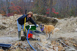
Before the slide show gets to the meat of the matter, there are a few shots of our venture to Garnet Hill, where we did find a few nice garnets and also the Robinson Copper Mine tailings across the basin on the other side from Garnet Hill. I hope you enjoy the show. I admit to viewing it in more than alittle discomfort!


Saturday, June 9, 2012

Lonely Ely

The only things left from the Ward Mining District are the cemetery and the nearby charcoal ovens that produced the charcoal from the pinyon pines (also the source of pine nuts) to smelt the ore from the mine. The rest of the town was literally moved across the mountain to the other side when the ore quality ran poor. Before the entire town could be moved, the rest burned to the ground leaving not so much of as a trace. But explore the town site we did and it was a wonderful day, a lonely day outside Ely, because with the exception of a lone cowboy moving his cattle, we did not meet up with another single sole. If you appreciate solitude, and a sense of being alone, this is a magnificent place. This was our first full day in the area and it was fine. Before we even left the coach (I showed you the unencumbered view out the "windshield" last post) there was, much to our surprise, a few shepherds driving an enormous flock of sheep across the open range prairie that constitutes our temporary homestead. At first we thought it was a wind event, a dust devil, but as the binoculars and the telephoto lens brought our environment into focus- there were dogs, there were shepherds, there was a flock. We got a bit of a late start on the day because we had to sit and watch the process play out. Never seen anything like it. They weren't cattle. They weren't cowboys. But it surely was a glimpse of the old West.....and it was special to say the least.

 After the mine district and the charcoal ovens (which is a state park venue) we hit the trading post, an antique (and nice junk) extravaganza in the middle of (pardon the language) "frigging nowhere". This place is so lonely, I mean sooooooo lonely that not even the junk yard was open because the owner "had to run into town for a minute." Ha!!!!

But we walked around, took a few pics, and can only wish we could have gotten into the closed buildings to see what they housed.

A flock of sheep is driven past:


On the way back to base camp, we stopped by a wildlife preserve area at Lake Comings. As always, water where it is not expected is especially beautiful and oddly colorful. Miss Joan, please write in with the name of this duck, cause I never saw it before anywhere! Blue bill. It was a great day. A lonely day. A day to feel the country we call our own in its rawest and oldest form.

Charcoal ovens that fed Ward Mine District, Willow Creek Trading Post, Comings Lake Wildlife Preserve:


Friday, June 8, 2012

Utah Basin To The Lonliest Highway in Nevada

If you ever, I say EVER, feel the need to get away from it all for awhile, please drive from Bryce Canyon, through the Utah Basin and on into Ely, Nevada, the first stop on what Time Magazine dubbed "The Loneliest Highway", US RT 50, which more or less follows the former route of the Pony Express. We were so alone for most of this trip that we actually felt excited if we saw another vehicle coming at us from the other direction! That, after all, suggested that we actually WERE going somewhere. I sometimes find reason to take exception to declarations made by Time Magazine, but they sure nailed this one! I tell ya it made you want to sing Mr. Lonely all day long. Now the scenery mind you, was pretty terrific, which is what makes it all worthwhile, but you need to see the scenery and not photograph that scenery because it isn't very often that there is anywhere to pull off for that photo-op. It was so bad (and so lonely) that at one point I just stopped dead in my lane of the road to walk back and use the bathroom...and that did NOT create any road hazard because at that point you could see a good "20 minutes" in either direction, and weren't nobody comin'.

There were some sections of the road posted to watch for wildlife but we saw absolutely nothing...and it certainly was not because of humans encroaching on wildlife habitat. There were none of them either! There was a short time of hyper-excitement, as we climbed the far side of the basin to climb out of the bowl we had been driving in, I about ran out of gears to get us up and over the top- I climbed the last 1/4 mile in first gear, and that was touch and go.

Tonight we are nestled into a small KOA at the outskirts of Ely (pronounced Eel-ee), Nevada. The first picture of the post is our unencumbered view out the front window of the coach. It looks like a western line Hallmark Card and while there is not much out there either, it is quite lovely to look at. True, the wind is gusting to 50, but that doesn't block the view, now does it?


For the record, we are now still in The Great Basin- a portion of the country that does not drain into any ocean. I have come to think of it as a gigantic stone bowl. From the bottom of the bowl the mountains are magnificent. From the ridge of the bowl, the valleys are spectacular in the distances below. From the downside of the bowl, you better hope the engine break keeps working and that you don't need the run-away-truck-ramp that is sure to be provided because it is necessary at times. And on the up-the-side of the bowl, well, be glad you have a first gear and hope the engine doesn't stall out. I guess I've come to think of it as the real "sport of bowling."

We visited the Chamber of Commerce in Ely this afternoon. Yes, they have one; it is a nice little town which we will explore along with its surroundings this week. We picked up a registration card of sorts- you get it stamped here and at each of the other five small towns along The Loneliest Road and then the state sends you a certificate for having survived the challenge of learning about the history of The Loneliest Road. We hope to earn one as we continue on our way after our stay here.

On this next image, you can see our walking sticks, which we made from Diamond Willow, harvested courtesy of Chicken Gold Camp, Chicken, Alaska, strapped to the front of the ATV. It never ceases to amaze me how many comments we get when we are using them- mostly from admirers who want to know what they are and where we got them. Linda Duke, showed me how to strip it, age it, and finish it- a process that takes the better part of a year. Light. Strong. Aged to perfection!


Here's a look at Tropic Reservoir- out in the boonies and located by an ATV ride from Ruby's back at Bryce Canyon. Water features like this are always a pleasant surprise in such an arid area.


On the way to Tropic Reservoir we passed a flat area known to be the location of a prairie dog village. We love visiting their little communities.


Monday, June 4, 2012

Hogback: Utah Scenic Byway 12


One hundred sixty miles round trip more or less. Non-stop spectacular scenery, much of it awe-inspiring, that changes every mile or so from one look to another. And finally punctuated by "the hogback" a ridge road with nothing but air and a drop off (and of course scenery) to either side. One hundred and fifty-nine and a half miles of relaxing, spectacular travel which turns into a half mile of heart stopping, blood pulsing, air gulping, steering wheel gripping, I'm-goona-die-if-the-wind-blows-now terror. Yea. That about sums it up. Oh. And that is on the way to Boulder, Utah from Bryce; then you gotta turn around and do it all again in the opposite direction. It's all true- but I wouldn't have missed it for the world. The experiencing of this road is the reason the road itself is a stand alone destination. Visitors come from all over to drive this perhaps the most beautiful of scenic byways in America. It was great. You should try it for yourself. But check the weather first. Because a windy day or a snow day or a freezing rain day? Listen to your Godfather: Forget about it!!!

A word about the pics. Tried to do just a random sample of what we saw. Tried to get the things we could get when we could pull over- many places you cannot. Also tried our first ever video clip for the blog, and while the fact that it is our first will be obvious and the sound terrible, I'm gonna include it anyhow (if I can figure out how to get it embedded) just to bring back the memory of that last half mile stretch or so.


In this shot, taken by telephoto lens, there are two Pueblo Indian made structures (a granary) about half way up the face of a cliff. To the eye, they appear like little tiny rock variations, but in actuality both structures are about the size of a person. Getting a handle on the scale of things in this landscape is very difficult. You will see another shot or two in the slide show.

Here, Marilyn takes a break after a strenuous rock climbing mission. At these altitudes, often 7 to 9 thousand feet, most activity places extra strain. Even a short hike, especially an up or down hill one, can take your breath away. Watch the slide show to see Marilyn's climbing adventure!


Well I can't seem to post our video to blogger so I've borrowed a you tube clip that looks alot like ours only ours was considerably longer. Until I can figure this thing out, I'll just feature this with end links to more of the same...

Saturday, June 2, 2012

Ruby's! Don't Take Your Love To Town.

So this is not much more than a simple photo essay on what there is to do at Ruby's Inn and RV Resort- and Ruby's "justabouteverythingelseyoucouldwantorneed," besides visiting Bryce Canyon on your own. One tip to ATVers: Ruby's gives out free with every stay some excellent DeLorme Trail Riding Maps with all kinds of nice trails and various skill levels available. Tomorrow , weather permitting, we'll be out on the trails.


Bryce! Nice!

Last week while we were exploring Zion National Park, we talked to quite a few people who had already visited Bryce Canyon and we asked them to compare and contrast. The typical response was, "Well, they're so different, it's like comparing apples to oranges." But yesterday while we were exploring Bryce, and discussing which of the two parks we liked the best, Marilyn remarked that it was more a matter of comparing "golf balls to kangaroos" than apples to oranges. I liked that image enough to want to repeat it here.

Let's start with a simple truth. Bryce is beautiful. Unusual. Different. Worth seeing. Nice! But having seen Zion first and only a week back, it seems natural to continue with the comparison. As we discussed this issue over the last couple days, we reached the conclusion that while we liked Bryce very well, we measurably prefer Zion. And the basic difference, other than structural, is that you look DOWN into the canyon to view Bryce, but you look UP from the canyon bottom to view Zion. There is something, for us anyhow, in the perspective that matters. We are more impressed lifting our eyes to the top of the mountains and toward the heavens than we are standing above and looking down. Bryce, if you will, is more like the Grand Canyon, and Zion has more the feel of the Rocky Mountains or glacial Alaska for example. Zion is also a much bigger space to explore and has much more in the way of modest and challenging hiking trails that lend themselves to making your visit there considerably more personal.

Now if you come this way, you should definitely see both. But if you even think you may feel similar to the way we feel about these landscapes, then by all means, come to Bryce first. You will be awed without the somewhat of a letdown we experienced having seen the massive impressiveness of Zion first. Marilyn's son Dick had told us quite a while back that Zion was THE most beautiful place. Pretty sure he nailed that call! He is a rock climber, too, so his opinion comes with a perspective of its own. Zion is "climbable" in may places. Bryce is not climbable as the brochure advises the soft sandstones of the eroded pillars in the canyon wouldn't support anything more than the weight of a chipmunk on the climbing ropes. And your eye will confirm that the minute you pull over at the first scenic lookout.

There is much more to see in this area, so that will be the mission for the rest of our scehuled week here.